Sri Lanka monitors possible Bay of Bengal low pressure as DMC urges rain preparedness
November 13 evening update: IMD confirms low-pressure formation
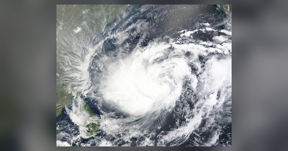
A low-pressure area formed over the southeast Bay of Bengal at 5.30am Indian Standard Time on November 13, according to the India Meteorological Department's sea-area bulletin valid from 09:00 to 21:00 UTC that day. This confirms formation, updating the earlier outlook below which said a low-pressure area was likely to form. The bulletin placed the system in the same region at 8.30am IST.
IMD forecasts northwestward movement, a well-marked low-pressure area on November 14 and a depression around the morning of November 15. It then forecasts north-northwestward movement and possible intensification into a cyclonic storm over the central Bay of Bengal around the evening of November 16. These later stages remain forecasts, not completed developments or a confirmed landfall track.
The bulletin lists widespread rain or thunderstorms with isolated heavy rain over the southeast Bay and much of the Andaman Sea. Its current storm-warning field says "No Storm Warning". That field does not cancel the developing-system outlook, rough-sea conditions or later warnings. Fishing and naval communities should use the latest official bulletins rather than assume either that a cyclone already exists or that marine risk has ended.
November 13 update: temporary rain easing does not end the weather risk
The Meteorology Department's forecast issued at 5.30am on November 13, Sri Lanka time, expects a temporary reduction in showery conditions that day. It still forecasts several spells of rain in the Eastern Province and Mullaitivu and Polonnaruwa districts, with showers or thundershowers at a few places in the Western, Sabaragamuwa, Central and Southern provinces after 1pm. These are forecast conditions, not a declaration that flood or lightning risks have ended.
The same morning's marine forecast says a low-pressure area is likely to form over the southeastern Bay of Bengal around November 13, move northwestwards and become a well-marked low-pressure area around November 14 and a depression around November 15. These stages remain projections in the bulletin. It does not confirm a named cyclone, a landfall location or a completed intensification. Fishing and naval communities are asked to follow later official forecasts and bulletins.
For waters around the island, the bulletin forecasts north-easterly winds of 20-30km/h, reaching about 45km/h at times, and fairly rough seas at times. Thunderstorms may bring temporary gusts of 60-70km/h and very rough seas. Those stronger conditions are thunderstorm-related possibilities, not the expected wind speed everywhere throughout the day. Showers or thunderstorms are forecast off the coast from Kankasanthurai to Galle via Trincomalee, Batticaloa and Hambantota.
On land, the department asks people to take precautions against localized strong winds and lightning during thunderstorms. Early-morning mist is possible in parts of the Western, Sabaragamuwa, Central and Uva provinces and Galle, Matara and Kurunegala districts. This update uses the dated 5.30am bulletin; earlier material below describes earlier assessments and should not be substituted for fresh official advice.
Earlier dated reports
Update November 12, 2026: In a November 11 briefing reported by published reporting, the Disaster Management Centre warned of possible heavy rain from November 13 to 15 as a low-pressure area could form over the southeastern Bay of Bengal around November 13. A separate November 11 report in the published report quotes the Meteorology Department describing possible effects from November 15 to 17 and saying there was not yet enough data for a precise forecast. These are dated assessments of an evolving system, not a confirmed storm track or a guarantee that every district will receive heavy rain. Residents and fishing communities should check the latest official advisories rather than rely on this article as a live warning.
Earlier assessments
In a further assessment reported on November 11, Meteorology Department Director General Ajith Wijemanne said officials were closely monitoring an atmospheric disturbance in the southeastern Bay of Bengal.
He said a developing system could move north near Sri Lanka's eastern coast, bringing heavy rain to the east and other areas from around November 15. Its development remained uncertain and further notices would be issued as needed.
Fishing and naval communities were urged to follow fresh forecasts. People in vulnerable areas were advised to watch flood and landslide warnings. This is a developing forecast, not a confirmed cyclone landfall announcement.
Earlier report (2026-11-08)
The Department of Meteorology has warned that a disturbed weather condition may develop around November 11 in the southeastern Bay of Bengal and near the Andaman Sea.
That condition could develop into a low-pressure area around November 13 and intensify into a depression around November 15, said the department's duty meteorologist Udeni Weerasinghe. The department has advised fishermen and naval personnel operating in these sea areas to be specially vigilant.
Meanwhile, rain or thundershowers are expected in many parts of the island after 1 pm today. Heavy rain of more than 100 millimetres is possible at some places in the Western, Sabaragamuwa and Central provinces and in the Galle, Matara and Kurunegala districts, Weerasinghe said. Rain is also possible during the published report.
The public is asked to take precautions against lightning, as temporarily strong winds may blow during thundershowers. Wind speeds in the sea areas around the island will be 20 to 30 kilometres per hour, but could increase to 60 to 70 kilometres per hour during thundershowers.
Update: November 12, 2026
The Disaster Management Centre has warned that heavy rain could affect several parts of Sri Lanka from November 13 to 15 if a low-pressure area develops over the southeastern Bay of Bengal. Spokesperson Pradeep Kodippili outlined the outlook at a November 11 briefing and urged people to follow official advisories.
The rain window described by disaster-management officials overlaps with, but is not identical to, the Meteorology Department's assessment of possible effects from November 15 to 17. The latter highlighted the Northern, North Central and Eastern provinces and said precise forecasts were not yet possible. These are developing assessments, not confirmation of a cyclone landfall.